2.3

Cutting-edge tools
and infrastructure

Meteorological activities are underpinned by specific infrastructure concerning, on the one hand, meteorological observation and, on the other, IT and communications. In 2016, the institution invested in improvements to several of these facilities: renewal of the Treillières radar near Nantes, installation of automatic radiosonde systems in Nouméa and Brest, deployment of some 150 automatic stations for measuring mercury in the soil, renewal of Overseas measurement concentration systems and, regarding Antilles-French Guiana and the Indian Ocean, provision of lightning detection datasets...

The year also saw considerable progress being made in terms of radar products, computing power and satellite and airborne observation systems.

A new product for observing snow and hail

Installation du radar de Treillières, près de Nantes. © Météo-France
Installation of the Treillières radar, near Nantes.
© Météo-France

A new version of radar calculator software was commissioned in 2016. This fine-tunes the determination of the radar echo type by introducing a classification of the hydrometeors reaching the ground (rain, freezing rain, sleet, snow, hail and so on) across Météo-France’s radar network. This new information, based on advanced use of dual-polarization technology, is a key piece of input data from the HYDRE product, which has been in operation since the end of the year.

Updated every 5 minutes and with a high resolution, HYDRE gives forecasters a clearer insight into critical winter situations as well as cases of instances of hail in mainland France. It makes it easier to report and discriminate between hydrometeors.

Discrimination des hydrométéores au sol HYDRE pour le 18 janvier 2016 à midi : pluie (vert), neige (bleu), pluie et de la neige mêlées (turquoise). La couleur bleu ciel indique des chutes de neige tenant au sol, la couleur blanche de la neige visible au sol par satellite. © Météo-France
Distinction of hydrometeors on the ground, HYDRE, for 18 January 2016 at midday: rain (green), snow (blue), sleet (turquoise). The sky-blue colour indicates snowfall that is settling on the ground, the white colour, snow visible on the ground by satellite.
© Météo-France


Triple the computing power

Le supercalculateur Bull installé au Centre national de calcul de Météo-France à Toulouse. © Météo-France, Jean-Marc Destruel.
The Bull supercomputer installed at Météo-France's national calculations centre in Toulouse.
© Météo-France, Jean-Marc Destruel.

The contract with the firm Bull, covering the 2013-2019 period, had set out two stages for building the institution’s intensive computing capacity: the first at the beginning of the contract, with the installation and commissioning of two computers at the Météopole and Espace Clément Ader sites in Toulouse, and the second in 2016, which is phasing in a computing power that is three times that of stage 1. The installation and configuration work for stage 2 went as planned, at the turn of 2016 for the Espace Clément Ader, and in the middle of the year for the Météopole National Computing Centre. For its part, the associated storage system has been specifically extended to keep pace with the increase in computing power.

In line with the targets set in the 2012-2016 targets and performance contract, Météo-France has equipped itself with competitive computing means compared with its major foreign counterparts, enabling it to conduct high-level research and to transfer the findings into practice. Examples of the many applications that have benefited from this scaling up in computing power include the AROME ensemble prediction system now up and running and participation in the international intercomparison project CMIP6 coordinated by the IPCC.

Drones for carrying out meteorological observations

Drone conçu par la société AJS et équipé de capteurs dynamiques et de compteurs d'aérosols, permettant d'étudier les échanges entre la mer et l'atmosphère et d'améliorer les modèles climatiques dans le cadre du projet MIRIAD.
Drone designed by the firm AJS and equipped with dynamic sensors and aerosol monitors for studying the exchanges between the sea and the atmosphere and for improving climate models as part of the MIRIAD project. © Sébastien Barrau.

Météo-France’s National Centre for Meteorological Research is fronting a new project to study the atmosphere at low altitude using instrumented drones: MIRIAD (system of drone-mounted scientific measurements of surface flows in the maritime environment). This is being conducted in partnership with the Aerology Laboratory of the Midi-Pyrenees Observatory and the Toulouse-based firm AJS*, and has received funding from the Occitania Region and the European Union.

The aim is to take very low altitude measurements over the sea using medium-sized drones (weighing around 25 kg) to document the detailed characteristics of the atmosphere (temperature, humidity, wind, radiation and sea spray) and better grasp sea-atmosphere exchanges. This research will help to improve weather forecasting and climate models.

The Boréal drones developed by AJS are 4 m-long devices that can fly for ten hours, cover a distance of 1,000 km and carry 5 kg worth of instruments. Equipped with altimetric radars, they will be able to make autonomous flights at very low altitude over the sea (up to 10 m in favourable conditions) so as to characterize the exchanges in this interface zone which had hitherto been inaccessible to measurements. In 2016, these altimetric radars were incorporated and tested successfully along the Aquitaine coast, in Montalivet.

When the project concludes at the end of 2018, Météo-France will implement this type of drone through the joint service unit SAFIRE.

* AJS, a private firm based in the Toulouse region and member of the Aerospace Valley cluster, specializes in the development and construction of large-capacity drone systems.

Instrumented aircraft: supporting French and European research

Financed by Météo-France, the CNRS and the French Government Space Agency (CNES), the French instrumented aircraft service for environmental research (SAFIRE) operates France’s aircraft for conducting research on the environment. It carries out field campaigns for improving knowledge about processes and control of the associated risks.

As France’s contribution to the Integrated Infrastructure Initiative EUFAR (European Facility for Airborne Research), SAFIRE hosts scientists from various European countries at regular intervals. In 2016, thanks to discussions with the different European partners, it was possible to establish the articles of association of an international not-for-profit association that will be up and running from 2017. Its mission will be to provide easier transnational access to aircraft and streamline the European fleet of research aircraft. In this context, talks are continuing to define the best long-term development strategy regarding the French fleet. Plans to acquire a new, higher-performing jet than SAFIRE’s current Falcon 20 (by 2020) are being discussed between the organizations supporting SAFIRE and their supervising ministries. The development of "drone" solutions for low-altitude flights is also in the pipeline.

Main achievements in 2016:

–DACCIWA project in Sub-Saharan Africa: documenting the aerosols emitted by human activities and their impact on cloud properties and the climate;

–EPATAN project, France’s contribution to the WMO’s World Weather Research Programme: study of the formation of storms over the Atlantic;

– development of a partnership with the French Aerospace Lab (ONERA) to develop the ability to observe continental surfaces.

A new satellite for cyclone surveillance in the Indian Ocean

Image satellite du globe du 12 decembre 2016 à 12 h UTC
Colour image above the Indian Ocean via Meteosat-8 on 12/12/2016 at 12:00 UTC. © Météo-France

In 2017, the Meteosat-8 satellite, the first of the Meteosat second-generation constellation (MSG) will take over from Meteosat-7 which, for the past twenty years or so, has been scanning the Indian Ocean. In 2016, the teams of Météo-France’s Space Meteorology Centre, in Lannion, have prepared for this transition by developing new products from Meteosat-8 datasets for mainland France and Météo-France’s Inter-Regional Management for the Indian Ocean (DIROI), which is particularly tasked with cyclone monitoring over this area. Equipped with 12 channels instead of 3, Meteosat-8 generates images every 15 minutes as opposed to 30 previously, with a much better spatial resolution than the older generation (3 km, and even 1 km for the visible channel at high-resolution, compared with 5 km). Météosat-8 also informs about clouds, their summit pressure and temperature. In addition, it provides colour compositions and data on sea surface temperature and radiation flux.

IASI: 10 years of high-resolution satellite data

Vue d'artiste du satellite Metop-A
Artist's impression of the Metop-A satellite. © NASA

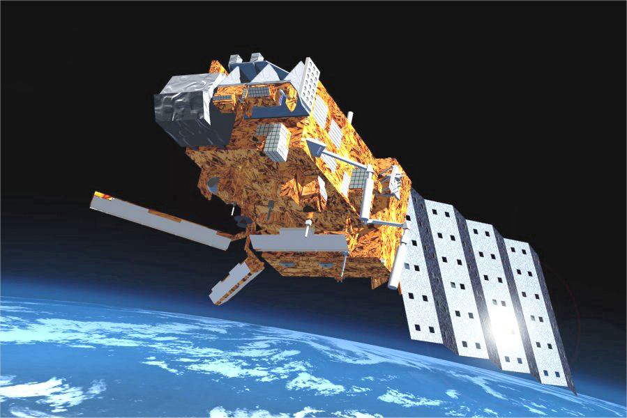
On 19 October 2006, the European orbiting satellite Metop-A, the first of a constellation dedicated to meteorological observations and studying the Earth, was launched from Baikonur, in Kazakhstan. It had a range of innovative instruments on board, not least the high-resolution infrared atmospheric sounding interferometer IASI, designed by the CNES, in liaison with EUMETSAT. In 2012, Metop-B, equipped with an identical sounding interferometer, was also launched into orbit.

Each of these interferometers generates over a million observations a day, which in turn provide information about 3D temperature and humidity atmospheric profiles. Today, the observations from the IASI interferometers account for half the data assimilated by ARPEGE, Météo-France’s numerical weather prediction (NWP) model. The latter make up as much as 25% of the information provided by observations at the initial state of this model. In the reduction of the forecasting error at a lead time of 24 hours, enabled by all of the observations, both IASIs make a 15% contribution.

IASI is also the only instrument to simultaneously measure, twice a day, across the globe in real time, the atmospheric concentrations of some twenty different chemical compounds. Such observations make it possible to monitor pollution plumes, particle emissions during volcanic eruptions, major fires, ammonia emissions associated with intensive farming and the formation of the hole in the ozone layer. Furthermore, IASI allows for continuous tracking of several climatic variables (including temperature, water vapour, clouds, aerosols and greenhouse gases).

A third IASI is due to be launched in 2018, thereby ensuring the continuity of the mission over more than 20 years.

Over a million observations a day
Discover the other chapters of the current part

2.2 Climate : tapping into data from the past to anticipate changes in the future